Service
Power Line Inspection by Drone & LiDAR
Automated detection of encroaching vegetation, real clearance measurement to every conductor, prioritised trimming plans — over kilometres of network, with no outage and no ground crew.
The problem
In tropical climates, vegetation grows back within months. For a power utility — transmission or distribution — walking the rights-of-way is slow, costly, sometimes hazardous, and blind under dense canopy. Every hurricane season shows the price of a branch too close to a conductor: outages, fire starts, emergency repairs. Documenting safety clearances and justifying trimming campaigns takes measurements, not estimates.
The CARIGE method
A LiDAR-equipped drone flies the corridor and captures millions of centimetre-grade georeferenced points: conductors, poles, ground, buildings and every layer of vegetation — including under dense canopy, where photography sees nothing.
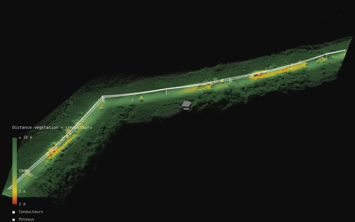
The point cloud is classified automatically, then every vegetation point is measured by its true 3D distance to the nearest conductor. Zones below safety clearances are detected, grouped into work orders and prioritised.
You receive deliverables you can use at once: an intervention app that runs in any browser, a clearance map of the corridor, Excel tables of trimming zones (location, length, priority) and GIS exports — GeoJSON, Shapefile — for your own tools.
Where we operate
CARIGE is based in Martinique and Guadeloupe and operates across French Guiana and the whole Caribbean — from Trinidad to the Bahamas, small islands included — as well as Central America. We work for grid operators in the French West Indies, including EDF (high-voltage transformer inspection). All service areas →
Local presence, ready to deploy
Based locally in the French West Indies, we deploy fast: urgent requests by WhatsApp at +596 696 19 95 82, reply within two hours, quote the same day. We can charter a private aircraft to almost any destination in the region and mobilise nearly the same day. Coverage of up to 1,000 hectares per day (two Matrice RTK drones).
Our automated-detection models — corrosion, deformation, damage, vegetation — are developed in the region, from our own field missions.
Let's talk about your network
Tell us about your line length and constraints: we reply with a method, a lead time and a sample deliverable.