Service
Drone LiDAR surveys
Topographic surveying by LiDAR is CARIGE's core business — three missions out of four, more than 600 hectares surveyed to date, with regularly renewed equipment. Where photography stops at the canopy, the laser reaches the ground and restores the true terrain, even under dense tropical vegetation.
Seeing under the canopy
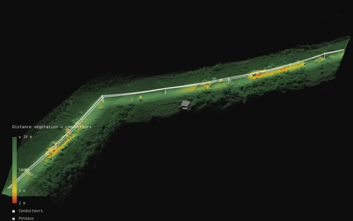
In the tropics, the question is not how to photograph vegetation but how to see through it. LiDAR fires millions of laser measurements per second; part of the pulses slips between leaves and hits the ground, cables and structures. The result is a georeferenced 3D point cloud in which every element — terrain, vegetation by layer, buildings, conductors — can be isolated, measured and monitored over time.
From laser to decision
Drone LiDAR flight along your footprint: power corridor, watershed, forest plot, structure. Point density matched to the goal, from terrain models to fine detection.
Automated cloud classification — ground, low/medium/high vegetation, buildings, structures — then measurements: canopy heights, conductor clearances, volumes, gully profiles.
Digital terrain model under the vegetation, derived maps, a point cloud you can browse with no software, LAS/LAZ and GIS exports for your teams.
Where we work
French West Indies, French Guiana, the whole Caribbean and Central America. LiDAR is our core trade: power corridors, vegetated hills, gullies, mangroves, quarries. All service areas →
Local presence, ready to deploy
Based locally in the French West Indies, we deploy fast: urgent requests by WhatsApp at +596 696 19 95 82, reply within two hours, quote the same day. We can charter a private aircraft to almost any destination in the region and mobilise nearly the same day. Coverage of up to 1,000 hectares per day (two Matrice RTK drones).
Our automated-detection models — corrosion, deformation, damage, vegetation — are developed in the region, from our own field missions.
Your terrain under the vegetation
Describe your footprint and your question: we reply with a point density, a method and a lead time.