Service
Natural disasters & damage assessment
After a hurricane, a landslide or a flood, deciding fast means seeing clearly: an aerial damage map, quantified and georeferenced, available within 24 to 48 hours.
After a hurricane, a flood or a landslide, every hour counts. Urgent requests by WhatsApp (+596 696 19 95 82), reply within two hours, usable mapping within 24 to 48 hours. We serve local authorities, CARICOM states and funders (NGOs, agencies), post-hurricane and post-disaster.
See fast, decide right
The Caribbean stacks up hazards: hurricanes, swells, landslides, earthquakes, lahars, eruptions. In the hours that follow, responders and authorities lack a reliable overview; satellite images arrive late and under clouds. A locally deployed drone produces, within hours, a fine orthophoto of the stricken area: you count affected buildings, measure the extent of a flow or a flood, prioritise response. Compared with an earlier state, it quantifies the damage.
The CARIGE method
Rapid deployment on site as soon as airspace allows. Flight tuned to the emergency: wide for the overview, tight on critical points.
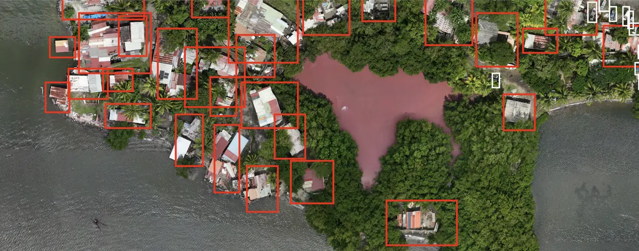
Damage mapping: flooded or buried footprints, affected buildings and infrastructure, comparison with the prior state where it exists, displaced volumes for a landslide or lahar. The processing can automatically count and measure affected objects — damaged areas, hit buildings, flooded or buried footprints — and classify them by damage type.
Georeferenced orthophoto and damage maps delivered in 24-48 h, usable by responders, authorities and insurers; 3D models for complex sites.
Where we work
French West Indies, French Guiana, the whole Caribbean and Central America — territories on the front line of natural hazards. References: monitoring of the Prêcheur lahars, mapping of flood-prone and landslide areas in Martinique. References: digital model of the Prêcheur river and volumes mobilised during lahars, mapping of mud plumes in Fort-de-France bay after a hurricane. All service areas →
Local presence, ready to deploy
Based locally in the French West Indies, we deploy fast: urgent requests by WhatsApp at +596 696 19 95 82, reply within two hours, quote the same day. We can charter a private aircraft to almost any destination in the region and mobilise nearly the same day. Coverage of up to 1,000 hectares per day (two Matrice RTK drones).
Our automated-detection models — corrosion, deformation, damage, vegetation — are developed in the region, from our own field missions.
Anticipate, or react fast
Describe your need — emergency response plan or post-event intervention: we reply with a setup, a mobilisation time and sample deliverables.